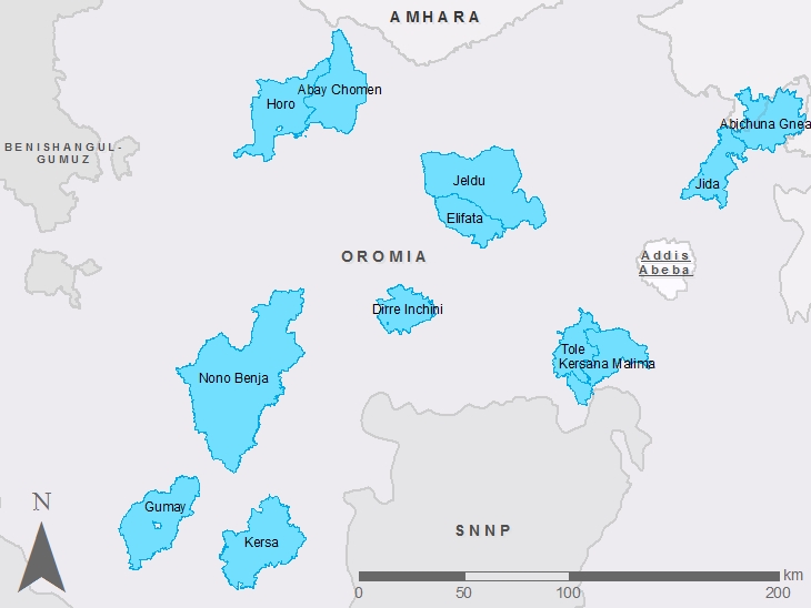
COWASH woredas in Oromia region
Below maps and databases of COWASH-woredas in Oromia-region.
Indicated years are accordingly to Ethiopian fiscal years (2016 G.C. ~ 2008 EFY).The year indicates the latest year of the data. Files include all constructed facilities until that year.
Map is only produced if there is 90 percent or more data available.
| ZONE | WOREDA | START YEAR | POPULATION 2013 | COVERAGE NWI | COWASH database | COWASH map |
| East Wellega | Abay Chomen | EFY 2007 | ||||
| East Wellega | Horo | EFY 2007 | No 2008 Data | No Map |
||
| Jimma | Gumay | EFY 2005 | 65554 | 67,73 | ||
| Jimma | Kersa | EFY 2005 | 189897 | 28,04 | ||
| Jimma | Nono Benja | EFY 2005 | 173907 | |||
| North Shewa | Abichuna Gnea | EFY 2005 | 82285 | 185,96 | ||
| North Shewa | Jida | EFY 2005 | 63698 | 121,72 | ||
| South West Shoa | Kersana Malima | EFY 2007 | ||||
| South West Shoa | Tole | EFY 2006 | 71227 | |||
| West Shoa | Dirre Inchini | EFY 2007 | ||||
| West Shoa | Elifata | EFY 2006 | 65874 | |||
| West Shoa | Jeldu | EFY 2006 | 223571 |


